Class "SpatialMultiPoints"
SpatialMultiPoints-class.RdClass for (irregularly spaced) MultiPoints
Slots
coords:Object of class
"list", containing the coordinates of point sets (each list element is a matrix)bbox:Object of class
"matrix", with bounding boxproj4string:Object of class
"CRS", projection string
Methods
- [
signature(x = "SpatialMultiPoints"): subsets point sets- coerce
signature(from = "SpatialPoints", to = "data.frame"): coerce to data.frame- coordinates
signature(obj = "SpatialMultiPoints"): retrieves all the coordinates, as one single matrix- plot
signature(x = "SpatialPoints", y = "missing"): plot points- summary
signature(object = "SpatialPoints"): summarize object- points
signature(x = "SpatialPoints"): add point symbols to plot- show
signature(object = "SpatialPoints"): prints coordinates- rbind
signature(object = "SpatialPoints"): rbind-like method
plot method arguments
The plot method for “SpatialPoints” objects takes the following arguments:
- x
object of class SpatialPoints
- pch
default 3; either an integer specifying a symbol or a single character to be used as the default in plotting points
- axes
default FALSE; a logical value indicating whether both axes should be drawn
- add
default FALSE; add to existing plot
- xlim
default NULL; the x limits (x1, x2) of the plot
- ylim
default NULL; the y limits of the plot
- ...
passed through
- setParUsrBB
default FALSE; set the
par“usr” bounding box, see note in Spatial-class- cex
default 1; numerical value giving the amount by which plotting text and symbols should be magnified relative to the default
- col
default 1; default plotting color
- lwd
default 1; line width
- bg
default 1; colour to be used for the background of the device region
Author
Edzer Pebesma, edzer.pebesma@uni-muenster.de
Examples
cl1 = cbind(rnorm(3, 10), rnorm(3, 10))
cl2 = cbind(rnorm(5, 10), rnorm(5, 0))
cl3 = cbind(rnorm(7, 0), rnorm(7, 10))
mp = SpatialMultiPoints(list(cl1, cl2, cl3))
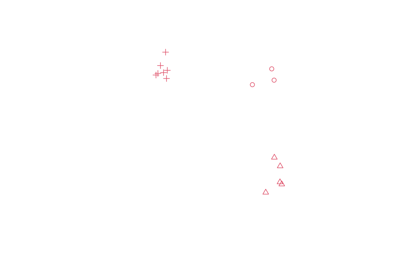
plot(mp, col = 2, cex = 1, pch = 1:3)
 mp
#> SpatialMultiPoints:
#> [[1]]
#> [,1] [,2]
#> [1,] 8.354729 8.871482
#> [2,] 10.118459 10.318447
#> [3,] 10.334439 9.285841
#>
#> [[2]]
#> [,1] [,2]
#> [1,] 10.869094 -0.0391045
#> [2,] 10.357445 2.2134383
#> [3,] 11.034092 -0.2316658
#> [4,] 9.571326 -0.9843264
#> [5,] 10.886738 1.4226089
#>
#> [[3]]
#> [,1] [,2]
#> [1,] -0.25811487 9.903283
#> [2,] 0.44084084 11.845590
#> [3,] 0.25428522 9.975245
#> [4,] -0.02562433 10.619211
#> [5,] -0.43270350 9.755816
#> [6,] 0.52600028 9.437798
#> [7,] 0.59928980 10.184914
#>
#> Coordinate Reference System (CRS) arguments: NA
mp[1:2]
#> SpatialMultiPoints:
#> [[1]]
#> [,1] [,2]
#> [1,] 8.354729 8.871482
#> [2,] 10.118459 10.318447
#> [3,] 10.334439 9.285841
#>
#> [[2]]
#> [,1] [,2]
#> [1,] 10.869094 -0.0391045
#> [2,] 10.357445 2.2134383
#> [3,] 11.034092 -0.2316658
#> [4,] 9.571326 -0.9843264
#> [5,] 10.886738 1.4226089
#>
#> Coordinate Reference System (CRS) arguments: NA
print(mp, asWKT=TRUE, digits=3)
#> SpatialMultiPoints:
#> geometry
#> 1 MULTIPOINT (8.35 8.87,10.1 10.3,10.3 9.29)
#> 2 MULTIPOINT (10.9 -0.0391,10.4 2.21,11 -0.232,9.57 -0.984,10.9 1.42)
#> 3 MULTIPOINT (-0.258 9.9,0.441 11.8,0.254 9.98,-0.0256 10.6,-0.433 9.76,0.526 9.44,0.599 10.2)
#> Coordinate Reference System (CRS) arguments: NA
mp
#> SpatialMultiPoints:
#> [[1]]
#> [,1] [,2]
#> [1,] 8.354729 8.871482
#> [2,] 10.118459 10.318447
#> [3,] 10.334439 9.285841
#>
#> [[2]]
#> [,1] [,2]
#> [1,] 10.869094 -0.0391045
#> [2,] 10.357445 2.2134383
#> [3,] 11.034092 -0.2316658
#> [4,] 9.571326 -0.9843264
#> [5,] 10.886738 1.4226089
#>
#> [[3]]
#> [,1] [,2]
#> [1,] -0.25811487 9.903283
#> [2,] 0.44084084 11.845590
#> [3,] 0.25428522 9.975245
#> [4,] -0.02562433 10.619211
#> [5,] -0.43270350 9.755816
#> [6,] 0.52600028 9.437798
#> [7,] 0.59928980 10.184914
#>
#> Coordinate Reference System (CRS) arguments: NA
mp[1:2]
#> SpatialMultiPoints:
#> [[1]]
#> [,1] [,2]
#> [1,] 8.354729 8.871482
#> [2,] 10.118459 10.318447
#> [3,] 10.334439 9.285841
#>
#> [[2]]
#> [,1] [,2]
#> [1,] 10.869094 -0.0391045
#> [2,] 10.357445 2.2134383
#> [3,] 11.034092 -0.2316658
#> [4,] 9.571326 -0.9843264
#> [5,] 10.886738 1.4226089
#>
#> Coordinate Reference System (CRS) arguments: NA
print(mp, asWKT=TRUE, digits=3)
#> SpatialMultiPoints:
#> geometry
#> 1 MULTIPOINT (8.35 8.87,10.1 10.3,10.3 9.29)
#> 2 MULTIPOINT (10.9 -0.0391,10.4 2.21,11 -0.232,9.57 -0.984,10.9 1.42)
#> 3 MULTIPOINT (-0.258 9.9,0.441 11.8,0.254 9.98,-0.0256 10.6,-0.433 9.76,0.526 9.44,0.599 10.2)
#> Coordinate Reference System (CRS) arguments: NA